Despite screwing up my knee… er, again… on this hike a few weeks ago, the Mt. Waterman loop is one of the prettiest dayhikes I’ve done this summer. Quiet, sparsely populated, and with excellent weather the day of my trip, it’s a pleasant ramble through shady pine forests and scenic ridges.
Ironically, I’d avoided the hike for several years. I had done the hike when I was much younger, and perhaps more goal-oriented, and found myself disappointed at the lack of a true “summit” at the top of the climb.
It’s true: the top of Waterman is a flat, rambling area with nice, but not “panoramic” views. Now, for me, the trip is more important, and the once-disappointing flattish summit is now a great hike and the perfect area for a long lunch break and extended nap.
Crossing the road from the parking area, pick up the trail at the large gray signs marking the wilderness area ahead.

Start of the Mt. Waterman loop trail along the side of the highway
The trail starts climbing gently, past areas of late season wildflowers. About .2 miles in you’ll cross the Mt. Waterman ski area service road; this will be your return route.

Late summer wildflowers
Cross the road and continue along the trail, passing by damaged trees from wildfires years ago.

Damaged, but still thriving tree along the trail
Occasionally, large granite boulders (a relative rarity in the chewed-up granite of the San Gabriels) appear here and there. Maybe it’s just me, or is there a face in this one…

Granite boulder/head along the trail
The trail continues up along the canyon, plunging through bright sunlight and deep shade. After 1.1 miles you’ll arrive at the ridge, looking down into Bear Creek Canyon. From this point south is designated wilderness area.

A flat section along the trail
The trail swings west, heading up the spine of the ridge a bit before entering a series of switchbacks heading up the slope. Topping the switchbacks, the trail continues around a small knob and back to the south side of the slope. To the south you can easily see Twin Peaks separating Devils Canyon and Bear Creek Canyon.

Along the ascending switchbacks

Young, bright needles show this year’s growth on a young pine tree
At 1.9 miles you’ll arrive at a trail junction. The path straight ahead continues for four miles and eventually returns to the highway at Three Points Junction. Our path turns right, heading up the mountain and towards the summit itself.
Near the top, look for a use trail on the left, which will take you directly to the summit. The summit itself isn’t distinct; instead you’ll find a long spine of exposed granite, laying about like the spine of some long-dead dinosaur.

Spiny granite boulders along the Waterman summit ridge
Relax, enjoy your lunch, drink in the views. But watch out for those who might also want to partake of your food!

Careful… he’s stalking your lunch…

View from the summit. Mt. Baldy is on the left, the LA basin towards the right
When you’ve had your fill of the sights, continue westward along any number of use trails. They will all pretty much converge at the west end of the summit ridge, which is also the end of the service road that will be our return route.
Picking up the service road, follow it past the various ski lifts and buildings of the Mt. Waterman Ski Resort. It hasn’t run often in recent years due to the drought, but can be quite popular when a good snowfall comes through.

Looking down from the ski resort down toward the flat, hot Antelope Valley
One of the things that perplexed me at the summit was the number of dragonflies, which are more commonly seen along stream bottoms. I scratched my head over this until I passed by this (artificial) pond along the way down.

Artificial pond near the summit
Filled with tadpoles, and busy with birds and insects, the rim along the edge also gives excellent views down the steep north slope of the San Gabriels to the flat Antelope Valley beyond.
Continue following the road, past the central buildings of the ski resort and continue down the mountain, more steeply than the uphill path. After 2.9 miles of decent, you will be returned to the highway, just east of your car. Turn left and head back to the parking area to complete the hike.
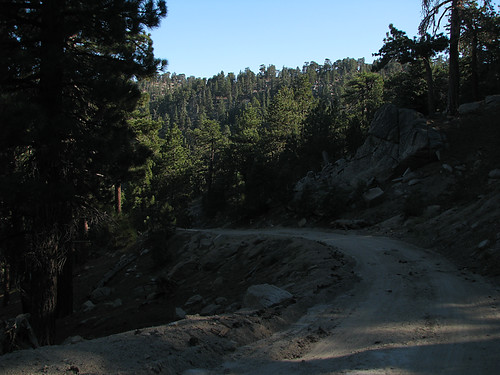
Descending the Mt. Waterman service road back to the trailhead
| Total Distance: 7.2 Miles
Elevation Gain/Loss: 1,400/1,400′ Website: http://www.fs.fed.us/r5/angeles/ Directions: From Interstate 210, exit Highway 2 North in La Canada Flintridge. Follow the highway to the trailhead at mile post 58.02. Park in the large turnout along the north side of the road or, if the turnout is full, along the highway shoulder out of traffic. Trailhead is located a few yards west on the other side of the highway. Park in the parking lot or along the road if the lot is full. National Forest Pass required. |


Lovely photos once again.
There IS someone trapped in that rock…
By: just a girl on August 26, 2008
at 11:23 pm
There is totallya face in that boulder! And it doesn’t look too impressed with itself either!
Great pics!
By: Ruby on August 27, 2008
at 5:15 am
How could you mention lunch without taking a picture. Where is all the sandwich porn lately?!?!?
By: charlotte harris on August 27, 2008
at 5:35 am
Aww, the chipmunk is so cute…but they will sooo rob you blind. Your pictures make me miss California.
By: Anya on August 27, 2008
at 5:58 am
Sounds like a great hike. Great pictures. I’ve tried to take a similar pine needle picture many times and have never been successful. I miss the mountains. Nebraska is a little flat.
By: Homer-Dog on August 27, 2008
at 7:17 am
What did you have for lunch? What kind of boots to you have? I think that chipmunk is adorable.
You take great pics.
By: Dingo on August 27, 2008
at 4:38 pm
That’s a determined chickmonk!
By: Aaron on August 27, 2008
at 7:01 pm
Wow that looks a heck of a lot prettier when it’s not covered in snow! I actually skied at Waterman in college. Now I’ll have to get back up there for a hike! Your pictures are beautiful.
By: Mel Heth on August 28, 2008
at 9:58 am
holy cow. that picture of antelope valley is AMAZING.
By: kristin on September 2, 2008
at 11:44 am
Sorry for the delayed reaction– WOW! WOW! WOW! This looks like an AWESOME hike! And I LOVE the tree that is still flourishing after the fire. Go nature!
By: Vicky on September 3, 2008
at 7:06 pm
Just A Girl – Trapped?
Ruby – He looks kinda Mayan to me…
Charlotte Harris – Heh, lunch was just trail mix and crackers. Sorry to disappoint.
Anya – They’re all little thieves!
Homer-Dog – It was a nice day, despite the knee. How far is it for you to the Rockies?
Dingo – The boots are Montrail Torre GTX Classics. Thanks for the compliment!
Aaron – Yeah, he was a brave little sucker.
Mel Heth – You should definitely do the hike!
Kristin – Thanks!
Vicky – No worries. The tree shot is cool, isn’t it?
By: geekhiker on September 3, 2008
at 9:17 pm
I would say the rockies are about a long days drive from here.
By: Homer-Dog on September 4, 2008
at 6:03 am
[…] Mt. Waterman on (single)geekhiker.wordpress.com […]
By: Mount Waterman Trail | Los Angeles | hikespeak.com on March 1, 2010
at 11:19 pm
[…] Waterman Trail. You can also do it as a loop hike by returning on the service road, as described here. Text and photography copyright 2012 by David W. Lockeretz, all rights reserved. Information and […]
By: Mt. Waterman « Nobody Hikes in L.A. on July 2, 2012
at 7:39 am
[…] Mount Waterman on geekhiker.com […]
By: Twin Peaks & Mount Waterman | Los Angeles | Hikespeak.com on July 26, 2015
at 10:23 am