I’ve been so out of the mood to write lately. But I did go hiking last weekend. So, here’s a boring hike post.
Hiking Mt. Islip from the north side is like ramble along a high sierra trail. Cool, with gentle breezes, and lined with sugar and jeffrey pines, Mt. Islip is a relaxing jaunt that I end up doing two to three times a year. Start early, take your time, breathe the clean mountain air, listen to the wind in the trees and enjoy a bit of solitude.
From the trailhead parking lot at Islip Saddle, cross the highway to the south side and start up the Pacific Crest Trail. The first few hundred yards of the trail are bright, exposed and a bit steep, and can be very warm, but you’ll soon enter the treeline. The climbs gently and contours along the north slope of Mt. Islip, shaded and cooled by the pine trees. It’s one of my favorite trail sections in Southern California. To your left, the view out over the Antelope Valley expands.
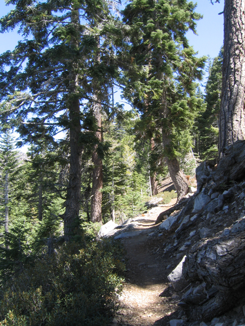
Trail to Mt. Islip
After 2.1 miles you arrive at Little Jimmy Campground. Nestled comfortably in a tree shaded flat, the campground has picnic tables, fire rings and pit toilets. A quarter mile past the campground, Little Jimmy spring trickles out of a pipe. The spring is usually very reliable, although this year (2007), with so little rain, the spring may dry by late summer or fall.
Heading up a steep slope past the spring, you quickly arrive at Windy Gap, an aptly named saddle between Mt. Islip and Mt. Hawkins. The area here and to the east was severely burned a couple of years ago and is only just beginning to recover. Luckily, our trail proceeds west up the ridge under a mixture of trees and chaparral.
As you hike up the ridge, you will see Crystal Lake and it’s campground below you. Crystal Lake is the only natural lake in the mountain range, but the campground is currently closed.
After a few hundred yards, you reach a trail junction where you turn left. The trail to the right leads back down to the west end of the campground. We continue up the ridge to a second trail junction where you will go right. Taking the left spur would take you back down to Crystal Lake.
Three more switchbacks and you arrive at the top of Mt. Islip. Here you’ll find the remnants of an old hut and the concrete pilings of the old fire lookout. Looking south, you can see the Crystal Lake basin and out over the greater Southern California area. To the north, Mt. Williamson and the Antelope Valley.

View towards Mt. Williamson & the Antelope Valley
Enjoy your time at the top (I usually eat lunch, read a book, and take a nap myself). When you’re done, return back down the trail, taking either route down to the campground, and then return along the trail to the parking lot.
Total Distance: 5.6 miles
Elevation Gain/Loss: 1,250’/1,250′
Website: http://www.fs.fed.us/r5/angeles/
Directions: From Interstate 210, exit Highway 2 North in La Canada Flintridge. Follow the highway to the parking lot at Islip Saddle, mile post 62.5 (as of this writing, this is the point at which Highway 2 is closed due to storm damage from two years ago). Park in the parking lot or along the road if the lot is full. National Forest Pass required.


I’m sorry to hear about your spirits. Hiking and getting outside almost always cheers me up, even if it is just for a little while.
P.S. Do you have any pictures of Crystal Lake?
P.S.S. There are only TWO natural, freshwater lakes in the whole state of Virginia!
By: tgaw on June 20, 2007
at 7:00 am
I’ve never actually been to Crystal Lake itself. For most of the time I’ve been in Southern California, Crystal Lake was a privately run campground, and it’s at the end of a narrow, one-way shelf road I drove once and never wanted to drive again. Right now, the lake is almost empty since we’re in severe drought conditions out here.
I did find this photo on the web, though:
http://www.answers.com/topic/crystal-lake-jpg
By: geekhiker on June 20, 2007
at 7:11 am
Hope you get some rain soon! Sounds like a nice day!
By: Ruby on June 20, 2007
at 10:23 am
Yo, GH, wheredya get that photo header on your page, that is a beautiful shot…
By: Darrin on July 13, 2007
at 7:05 am
Thanks for the compliment Darrin. Took the picture myself (so please don’t steal it!). It’s at Patrick’s Point State Park in Northern California.
By: geekhiker on July 13, 2007
at 11:43 am
Years ago while hiking here in winter snow, I was standing at windy gap jut looking out. Suddenly both feet slipped out from under me and I proceeded to slide at high speed on my backpack down the very steep slope. I slammed into a downed tree just before going over a huge cliff that definitely would have ended my life that day. I spent the next two hours climbing back up the slope. I had to cut up my hammock and make it into a rope to get up. It was too step to climb by hand. Went back to spend the night at little jimmy campground. Slept on about a foot of snow which was fine, but in the morning, I felt like someone had beat me with a bat. Continued on to Baden Powell the next day without incident. That was the closest I ever came to dying. Moral of the story, don’t loiter in a dangerous spot. It was an adventure though and I like that.
By: G. Smith on June 5, 2009
at 8:41 pm